Object
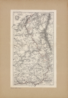
Title: Die Rückreise der arktischen expedition des Crafen Hans Wiltschek durch Nordost-Russland von der Petschora-Mündung bis Nischnii Nowogorod 3. Sept. 25. Okt. 1872
Description:
1 mapa 47x27 cm ; Skala 1:3 700 000 ; Nad mapą notka: "Petermann's geographische Mittheilungen. Jahrgang 1874, Tafel 6." ; Skala i podzialka liniowa w lewym górnym rogu
Publisher:
Justus Perthes ; Druck von C. Hellfarth
Place of publication:
Format:
Identifier:
Source:
<sygn. 14129> ; Ze zbiorów prof. F. Uhorczaka
Language:
Rights:
Source of sponsorship :
Object collections:
Last modified:
Apr 28, 2015
In our library since:
Apr 15, 2015
Number of object content hits:
23
Number of object content views in DjVu format
23
All available object's versions:
https://bc.umcs.pl/publication/20647

